Filter
3200
Text search:
maps
Featured
384
767
Language
3135
91
75
46
31
29
23
7
5
4
4
3
3
3
2
2
2
2
2
2
2
1
1
1
1
1
1
1
1
1
1
1
1
1
1
1
1
1
1
1
Document type
1329
723
506
280
156
85
36
33
20
17
5
4
2
1
Countries
202
81
63
60
54
52
51
48
45
43
43
42
42
39
34
34
33
28
26
25
24
24
23
22
22
22
21
20
19
18
18
17
17
16
15
13
13
13
12
11
11
11
11
10
10
9
9
8
8
8
7
7
7
6
6
6
6
6
6
6
5
5
5
5
5
5
5
4
4
4
4
4
4
3
3
3
3
3
3
3
3
3
3
3
2
2
2
2
2
2
2
2
2
2
2
2
2
2
2
2
2
2
2
2
2
2
2
2
2
2
2
1
1
1
1
1
1
1
1
1
1
1
1
1
1
1
1
1
1
1
1
1
1
1
1
1
1
Authors & Publishers
936
313
168
154
94
85
65
54
32
29
20
20
19
19
16
14
14
13
13
13
12
12
11
10
9
9
8
8
8
8
8
8
8
8
8
8
8
7
7
7
7
7
6
6
6
6
5
5
5
5
5
5
5
5
5
5
5
5
5
5
5
4
4
4
4
4
4
4
4
4
4
4
4
4
4
4
4
4
4
4
4
4
4
4
4
4
4
4
4
4
4
4
4
4
3
3
3
3
3
3
3
3
3
3
3
3
3
3
3
3
3
3
3
3
3
3
3
3
3
3
3
3
3
3
3
3
3
3
3
2
2
2
2
2
2
2
2
2
2
2
2
2
2
2
2
2
2
2
2
2
2
2
2
2
2
2
2
2
2
2
2
2
2
2
2
2
2
2
2
2
2
2
2
2
2
2
2
2
2
2
2
2
2
2
2
2
2
2
2
2
2
2
2
2
2
2
2
2
2
2
2
2
2
2
2
2
2
2
2
2
2
2
2
2
2
2
2
2
2
2
2
2
2
2
2
2
2
2
2
2
2
2
2
2
2
2
2
2
2
2
2
2
2
2
2
2
2
2
2
1
1
1
1
1
1
1
1
1
1
1
1
1
1
1
1
1
1
1
1
1
1
1
1
1
1
1
1
1
1
1
1
1
1
1
1
1
1
1
1
1
1
1
1
1
1
1
1
1
1
1
1
1
1
1
1
1
1
1
1
1
1
1
1
1
1
1
1
1
1
1
1
1
1
1
1
1
1
1
1
1
1
1
1
1
1
1
1
1
1
1
1
1
1
1
1
1
1
1
1
1
1
1
1
1
1
1
1
1
1
1
1
1
1
1
1
1
1
1
1
1
1
1
1
1
1
1
1
1
1
1
1
1
1
1
1
1
1
1
1
1
1
1
1
1
1
1
1
1
1
1
1
1
1
1
1
1
1
1
1
1
1
1
1
1
1
1
1
1
1
1
1
1
1
1
1
1
1
1
1
1
1
1
1
1
1
1
1
1
1
1
1
1
1
1
1
1
1
1
1
1
1
1
1
1
1
1
1
1
1
1
1
1
1
1
1
1
1
1
1
1
1
1
1
1
1
1
1
1
1
1
1
1
1
1
1
1
1
1
1
1
1
1
1
1
1
1
1
1
1
1
1
1
1
1
1
1
1
1
1
1
1
1
1
1
1
1
1
1
1
1
1
1
1
1
1
1
1
1
1
1
1
1
1
1
1
1
1
1
1
1
1
1
1
1
1
1
1
1
1
1
1
1
1
1
1
1
1
1
1
1
1
1
1
1
1
1
1
1
1
1
1
1
1
1
1
1
1
1
1
1
1
1
1
1
1
1
1
1
1
1
1
1
1
1
1
1
1
1
1
1
1
1
1
1
1
1
1
1
1
1
1
1
1
1
1
1
1
1
1
1
1
1
1
1
1
1
1
1
1
1
1
1
1
1
1
1
1
1
1
1
1
1
1
1
1
1
1
1
1
1
1
1
1
1
1
1
1
1
1
1
1
1
1
1
1
1
1
1
1
1
1
1
1
1
1
1
1
1
1
1
1
1
1
1
1
1
1
1
1
1
1
1
1
1
1
1
1
1
1
1
1
1
1
1
1
1
1
1
1
1
1
1
1
1
1
1
1
1
1
1
1
1
1
1
1
1
1
1
1
1
1
1
1
1
1
1
1
1
1
1
1
1
1
1
1
1
1
1
1
1
1
1
1
1
1
1
1
1
1
1
1
1
1
1
1
1
1
1
1
1
1
1
1
1
1
1
1
1
1
1
1
1
1
1
1
1
1
1
1
1
1
1
1
1
1
1
1
1
1
1
1
1
1
1
1
1
1
1
1
1
1
1
1
1
1
1
1
1
1
1
1
1
1
1
1
1
1
1
1
1
1
1
1
1
1
1
1
1
1
1
1
1
1
1
1
1
1
1
1
1
1
1
1
1
1
1
1
1
1
1
1
1
1
1
1
1
1
1
1
1
1
1
1
1
1
1
1
1
1
1
1
1
1
1
1
1
1
1
1
1
1
1
1
1
1
1
1
1
1
1
1
1
1
1
1
1
1
1
1
1
1
1
1
1
1
1
1
1
1
1
1
1
1
1
1
1
1
1
1
1
1
1
1
1
1
1
1
1
1
1
1
1
1
1
1
1
1
1
1
1
1
1
1
1
1
1
1
1
1
1
1
1
1
1
1
1
1
1
1
1
1
1
1
1
1
1
1
1
1
1
1
1
1
1
1
1
1
1
1
1
1
1
1
1
1
1
1
1
1
1
1
1
1
1
1
1
1
1
1
1
1
1
1
1
1
1
1
1
1
1
1
1
1
1
1
1
1
1
1
1
1
1
1
1
1
1
1
1
1
1
1
1
1
1
1
1
1
1
1
1
1
1
1
1
1
1
1
1
1
1
1
1
1
1
1
1
1
1
1
1
1
1
1
1
1
1
1
1
1
1
1
1
1
1
1
1
1
1
1
1
1
1
1
1
1
1
1
1
1
1
1
1
1
1
1
1
1
1
1
1
1
1
1
1
1
1
1
1
1
1
1
1
1
1
1
1
1
1
1
1
1
1
1
1
1
1
1
1
1
1
1
1
1
1
1
1
1
1
1
1
1
1
1
1
1
1
1
1
1
1
1
1
1
1
1
1
1
1
1
1
1
1
1
1
1
1
1
1
1
1
1
1
1
1
1
1
1
1
1
1
1
1
1
1
1
1
1
1
1
1
1
1
1
1
1
1
1
1
1
1
1
1
1
1
1
1
1
1
1
1
1
1
1
1
1
1
1
1
1
1
1
1
1
1
1
1
1
1
1
1
1
1
1
1
1
1
1
1
1
1
1
1
1
1
1
1
1
1
1
1
1
1
1
1
1
1
1
1
1
1
1
1
1
1
1
1
1
1
1
1
1
1
1
1
1
1
1
1
1
1
1
1
1
1
1
1
1
1
1
1
1
1
1
1
1
1
1
1
1
1
1
1
1
1
1
1
1
1
1
1
1
1
1
1
1
1
1
1
1
1
1
1
1
1
1
1
1
1
1
1
1
1
1
1
1
1
1
1
1
1
1
1
1
1
1
1
1
1
1
1
1
1
1
1
1
1
1
1
1
1
1
1
1
1
1
1
1
1
1
1
1
1
1
1
1
1
1
1
1
1
1
1
1
1
1
1
1
1
1
1
1
1
1
1
1
1
1
1
1
1
1
1
1
1
1
1
1
1
1
1
1
1
1
1
1
1
1
1
1
1
1
1
1
1
1
1
1
1
1
1
1
1
1
1
1
1
1
1
1
1
1
1
1
1
1
1
1
1
1
1
1
1
1
1
1
1
1
1
1
1
1
1
1
1
1
1
1
1
1
1
1
1
1
1
1
1
1
1
1
1
1
1
1
1
1
1
1
1
1
1
1
1
1
1
1
1
1
1
1
1
1
1
1
1
1
1
1
1
1
1
1
1
1
1
1
1
1
1
1
1
1
1
1
1
1
1
1
1
1
1
1
1
1
1
1
1
1
1
1
1
1
1
1
1
1
1
1
1
1
1
1
1
1
1
1
1
1
1
1
1
1
1
1
1
1
1
1
1
1
1
1
1
1
1
1
1
1
1
1
1
1
1
1
1
1
1
1
1
1
1
1
1
1
1
1
1
1
1
1
1
1
1
1
1
1
1
1
1
1
1
1
1
1
1
1
1
1
1
1
1
1
1
1
1
1
1
1
1
1
1
1
1
1
1
1
1
1
1
1
1
1
1
1
1
1
1
1
1
1
1
1
1
1
1
1
1
1
1
1
1
1
1
1
1
1
1
1
1
1
1
1
1
1
1
1
1
1
1
1
1
1
1
1
1
1
1
1
1
1
1
1
1
1
1
1
1
1
1
1
1
1
1
1
1
1
1
1
1
1
1
1
1
1
1
1
1
1
1
1
1
1
1
1
1
1
1
1
1
1
1
1
1
1
1
1
1
1
1
1
1
1
1
1
1
1
1
1
1
1
1
1
1
1
1
1
1
1
1
1
1
1
1
1
1
1
1
1
1
1
1
1
1
1
1
1
1
1
1
1
1
1
1
1
1
1
1
1
1
1
1
1
1
1
1
1
1
1
1
1
1
1
1
1
1
1
1
Publication Years
1229
1719
243
8
1
Category
736
381
287
275
257
88
69
Toolboxes
216
198
193
192
189
114
110
107
104
104
103
93
81
78
67
67
63
56
52
43
39
30
29
23
3
2
2
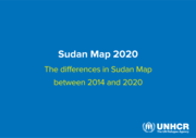
Syria. Humanitarian Response
recommended
With the Syria Crisis now in its eighth year, civilians continue to bear the brunt of a conflict marked by unparalleled suffering, destruction and disregard for human life. 13.1 million people require humanitarian assistance, including over 2 million people in hard-to-reach areas, where they are exp
...
osed to grave protection threats.
Over half of the population has been forced from their homes, and many people have been displaced multiple times. Children and youth comprise more than half of the displaced, as well as half of those in need of humanitarian assistance. Parties to the conflict act with impunity, committing violations of international humanitarian and human rights law.
On this resource page you can download situation reports, maps, infographics and documents
more
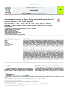
To guide One Health capacity building efforts in the Republic of Guinea in the wake of the 2014–2016 Ebola virus disease (EVD) outbreak, we sought to identify and assess the existing systems and structures for zoonotic disease detection and control. We partnered with the government ministries resp
...
onsible for human, animal, and environmental health to identify a list of zoonotic diseases – rabies, anthrax, brucellosis, viral hemorrhagic fevers, trypanosomiasis and highly pathogenic avian influenza – as the country's top priorities. We used each priority disease as a case study to identify existing processes for prevention, surveillance, diagnosis, laboratory confirmation, reporting and response across the three ministries. Results were used to produce disease-specific systems “maps” emphasizing linkages across the systems, as well as opportunities for improvement. We identified brucellosis as a particularly neglected condition. Past efforts to build avian influenza capabilities, which had degraded substantially in less than a decade, highlighted the challenge of sustainability. We observed a keen interest across sectors to reinvigorate national rabies control, and given the regional and global support for One Health approaches to rabies elimination, rabies could serve as an ideal disease to test incipient One Health coordination mechanisms and procedures. Overall, we identified five major categories of gaps and challenges: (1) Coordination; (2) Training; (3) Infrastructure; (4) Public Awareness; and (5) Research. We developed and prioritized recommendations to address the gaps, estimated the level of resource investment needed, and estimated a timeline for implementation. These prioritized recommendations can be used by the Government of Guinea to plan strategically for future One Health efforts, ideally under the auspices of the national One Health Platform. This work demonstrates an effective methodology for mapping systems and structures for zoonotic diseases, and the benefit of conducting a baseline review of systemic capabilities prior to embarking on capacity building efforts.
more

2nd edition. The purpose of the WHO human health risk assessment toolkit: chemical hazards is to provide its users with guidance to identify, acquire and use the information needed to assess chemical hazards, exposures and the corresponding health risks in their given health risk assessment contexts
...
at local and/or national levels.
The Toolkit provides road maps for conducting a human health risk assessment, identifies information that must be gathered to complete an assessment and provides electronic links to international resources from which the user can obtain information and methods essential for conducting the human health risk assessment
more
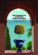
The Atlas of Palliative Care in the Eastern Mediterranean Region is the first systematic attempt to assess the status of resources, activities, and needs of palliative care in the region. It provides a comparative picture of the current state of palliative care in simple and clear graphics, utilisin
...
g texts, tables, figures and maps that reproduce information given by national palliative care leaders in the Eastern Mediterranean. This information is essential for the appropriate planning of the development of palliative care for this region.
more
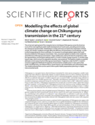
The arrival and rapid spread of the mosquito-borne viral disease Chikungunya across the Americas is one of the most significant public health developments of recent years, preceding and mirroring the subsequent spread of Zika. Globalization in trade and travel can lead to the importation of these vi
...
ruses, but climatic conditions strongly affect the efficiency of transmission in local settings. In order to direct preparedness for future outbreaks, it is necessary to anticipate global regions that could become suitable for Chikungunya transmission. Here, we present global correlative niche models for autochthonous Chikungunya transmission. These models were used as the basis for projections under the representative concentration pathway (RCP) 4.5 and 8.5 climate change scenarios. In a further step, hazard maps, which account for population densities, were produced. The baseline models successfully delineate current areas of active Chikungunya transmission. Projections under the RCP 4.5 and 8.5 scenarios suggest the likelihood of expansion of transmission-suitable areas in many parts of the world, including China, sub-Saharan Africa, South America, the United States and continental Europe. The models presented here can be used to inform public health preparedness planning in a highly interconnected world.
more
In order to target resources and drugs to reach trachoma elimination targets by the year 2020, data on the burden of disease are required. Using prevalence data in African countries derived from the Global Atlas of Trachoma (GAT), the distribution of trachoma continues to be focused in East and West
...
Sub-Saharan Africa, North Africa and a few endemic countries in Central Sub-Saharan Africa. Currently, 129.4 million people are estimated to live in areas that are confirmed to be trachoma endemic and 98 million are known to require access to the SAFE strategy. The maps and information presented in this work highlight the GAT as important open-access planning and advocacy tool for efforts to finalize trachoma mapping and assist national programmes in planning interventions.
more

The boundaries and names shown and the designations used on this map do not imply the expression of any opinion whatsoever on the part of the World Health Organization concerning the legal status of any country, territory, city or area or of its authorities,
or concerning the delimitation of its fr
...
ontiers or boundaries. Dotted and dashed lines on maps represent approximate border lines for which there may not yet be full agreement.
more
The boundaries and names shown and the designations used on this map do not imply the expression of any opinion whatsoever on the part of the World Health Organization concerning the legal status of any country, territory, city or area or of its authorities, or concerning the delimitation of its fro
...
ntiers or boundaries. Dotted lines on maps represent approximate border lines for which there may not yet be full agreement.
more
As part of its 2019–2030 global strategy for the prevention and control of snakebite envenoming, WHO is launching a new Snakebite Information and Data Platform. This is the result of collaboration between the Departments of Control of Neglected Tropical Diseases (WHO/NTD) and Data Delivery for Imp
...
act & Analytics (WHO/DDI).
With support from the WHO GIS Centre for Health, the platform is developed with a new generation of ArcGIS software. It comprises advanced tools for managing, analyzing, and visualizing updated multi-sourced data, providing an interactive and participative user experience. It includes updated range maps of all medically important venomous snakes, other relevant information, and an integrated antivenom products database.
more
The boundaries and names shown and the designations used on this map do not imply
the expression of any opinion whatsoever on the part of the World Health Organization
concerning the legal status of any country, territory, city or area or of its authorites, or
concerning the delimitation of its f
...
rontiers or boundaries. Dotted lines on maps
represent approximate border lines for which there may not yet be full agreement.
more
Background: The last decade has seen a dramatic increase in international and domestic funding for malaria control, coupled with important declines in malaria incidence and mortality in some regions of the world. As the ongoing climate of financial uncertainty places strains on investment in global
...
health, there is an increasing need to audit the origin, recipients and geographical distribution of funding for malaria control relative to populations at risk of the disease. Methods: A comprehensive review of malaria control funding from international donors, bilateral sources and national governments was undertaken to reconstruct total funding by country for each year 2006 to 2010. Regions at risk from Plasmodium falciparum and/or Plasmodium vivax transmission were identified using global risk maps for 2010 and funding was assessed relative to populations at risk. Those nations with unequal funding relative to a regional average were identified and potential explanations highlighted, such as differences in national policies, government inaction or donor neglect.
more
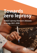
The Global Leprosy Strategy 2021–2030 “Towards zero leprosy” was developed through a broad consultative process with all major stakeholders during 2019 and 2020. Valuable inputs were provided by national leprosy programme managers, technical agencies, public health and leprosy experts, funding
...
agencies and persons or members of communities directly affected by leprosy.
The Strategy aims to contribute to achieving the Sustainable Development Goals. It is structured along four pillars:
(i) implement integrated, country-owned zero leprosy road maps in all endemic countries;
(ii) scale up leprosy prevention alongside integrated active case detection;
(iii) manage leprosy and its complications and prevent new disability; and
(iv) combat stigma and ensure human rights are respected. Interruption of transmission and elimination of disease are at the core of the Strategy.
more
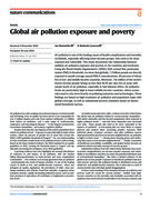
Air pollution is one of the leading causes of health complications and mortality worldwide, especially affecting lower-income groups, who tend to be more exposed and vulnerable. This study documents the relationship between ambient air pollution exposure and poverty in 211 countries and territories.
...
Using the World Health Organization’s (WHO) 2021 revised fine particulate matter (PM2.5) thresholds, we show that globally, 7.3 billion people are directly exposed to unsafe average annual PM2.5 concentrations, 80 percent of whom live in low- and middle-income countries. Moreover, 716 million of the world’s lowest income people (living on less than $1.90 per day) live in areas with unsafe levels of air pollution, especially in Sub-Saharan Africa. Air pollution levels are particularly high in lower-middle-income countries, where economies tend to rely more heavily on polluting industries and technologies. These findings are based on high-resolution air pollution and population maps with global coverage, as well as subnational poverty estimates based on harmonized household surveys.
more
Read me – About the Health Financing Toolbox
recommended
The Health Financing Toolbox is designed to equip development cooperation stakeholders with essential information on the internal and external financing of nation states, with a particular emphasis on health financing. To achieve this, the Health Financing Toolbox includes a comprehensive collection
...
of topic-specific documents, along with numerous interactive world maps and data tables. These digital tools enable users to explore key aspects of health financing across all countries, with data categorized into both economic and medical dimensions.
more
The ECDC's Cholera Monthly Surveillance page provides up-to-date data on cholera cases reported in Europe and globally. It monitors outbreaks, tracks trends, and analyzes the spread of the disease to support public health responses. The page includes interactive
...
maps, statistics, and reports to help policymakers, researchers, and healthcare professionals understand cholera’s epidemiology and implement preventive measures.
more
The Malaria Atlas Project (MAP) is a global research initiative that provides high-resolution, evidence-based spatial data on malaria transmission, risk and impact. MAP combines field data, satellite imagery, and advanced geostatistical modelling to deliver open-access
...
maps, datasets, and analytical tools that support malaria control and elimination strategies worldwide. MAP empowers researchers, policymakers, and public health practitioners by providing them with accurate, up-to-date geographic insights to inform resource allocation and intervention planning.
more
Zzapp creates malaria elimination strategies powered by artificial intelligence, and delivers them directly to the field through a dedicated mobile app. Malaria elimination strategies powered by AI. The Zzapp software system supports the planning and implementation of malaria elimination operations,
...
as well as mosquito surveillance activities.
By analyzing satellite images and topographical maps, Zzapp’s AI identifies malaria transmission hotspots and optimizes malaria elimination strategies for each location. Our map-based mobile app conveys the AI strategies to field workers as simple instructions, ensuring accurate implementation and quick feedback from the field.
more
Recent forecasts by the Food and Agriculture Organization of the United Nations (FAO) have indicated a risk of locust invasion in West Africa from June 2020. From East Africa, some swarms could reach the eastern part of the Sahel and continue westwards from Chad to Mauritania.
Surveillance and co
...
ntrol teams will be mobilized across the region with a focus on Burkina Faso, Chad, Mali, Mauritania, and the Niger, and extended to Senegal. Countries such as Cameroon, the Gambia and Nigeria are also on watch in the event that desert locust spreads to these highly acute food-insecure countries. Since the region could be threatened in the coming months, FAO is strongly encouraging no regret investments in preparedness and anticipatory action to control swarms and safeguard livelihoods, given already high levels of acute food insecurity. Therefore, cost estimates for preparedness, anticipatory action and rapid response have been assessed.
more