Filter
3377
Text search:
map
Featured
282
1079
Language
3243
104
67
40
31
30
17
12
9
4
4
3
3
3
3
3
2
2
2
2
2
2
2
2
2
2
1
1
1
1
1
1
1
1
1
1
1
1
1
1
1
1
1
1
1
1
1
1
1
Document type
1734
684
327
207
188
58
54
36
33
29
22
3
2
Countries
177
123
102
99
99
90
73
72
71
70
69
69
66
66
59
50
50
49
48
46
45
39
38
37
37
36
33
31
30
28
28
25
24
24
21
21
20
20
18
17
16
15
14
14
14
13
13
12
12
12
12
11
10
9
9
8
8
8
8
8
8
7
7
7
7
7
7
6
5
5
5
5
5
5
4
4
4
4
4
4
4
4
3
3
3
3
3
3
3
3
3
3
3
2
2
2
2
2
2
2
2
2
2
2
2
2
2
2
2
2
2
2
1
1
1
1
1
1
1
1
1
1
1
1
1
1
1
1
1
1
1
1
1
1
1
1
1
1
1
1
1
1
Authors & Publishers
390
98
96
82
76
70
65
58
33
32
29
29
28
20
20
19
18
17
17
17
16
16
16
16
15
15
14
13
12
12
12
12
11
11
11
11
10
10
9
9
9
9
9
9
8
8
8
8
8
8
8
8
8
8
8
8
8
8
7
7
7
7
7
7
7
7
7
7
7
7
7
6
6
6
6
6
6
6
6
6
6
6
6
6
5
5
5
5
5
5
5
5
5
5
5
5
5
5
5
5
5
5
5
5
5
5
4
4
4
4
4
4
4
4
4
4
4
4
4
4
4
4
4
4
4
4
4
4
4
4
4
4
4
4
4
4
3
3
3
3
3
3
3
3
3
3
3
3
3
3
3
3
3
3
3
3
3
3
3
3
3
3
3
3
3
3
3
3
3
3
3
3
3
3
3
3
3
3
3
3
3
3
3
3
3
3
3
3
3
3
3
3
3
3
3
3
3
3
3
3
3
3
3
3
3
3
3
3
3
3
3
3
3
3
3
3
3
3
3
3
3
3
3
3
3
3
2
2
2
2
2
2
2
2
2
2
2
2
2
2
2
2
2
2
2
2
2
2
2
2
2
2
2
2
2
2
2
2
2
2
2
2
2
2
2
2
2
2
2
2
2
2
2
2
2
2
2
2
2
2
2
2
2
2
2
2
2
2
2
2
2
2
2
2
2
2
2
2
2
2
2
2
2
2
2
2
2
2
2
2
2
2
2
2
2
2
2
2
2
2
2
2
2
2
2
2
2
2
2
2
2
2
2
2
2
2
2
2
2
2
2
2
2
2
2
2
2
2
2
2
2
2
2
2
2
2
2
2
2
2
2
2
2
2
2
2
2
2
2
2
2
2
2
2
2
2
2
2
2
2
2
2
2
2
2
2
2
2
2
2
2
2
2
2
2
2
2
2
2
2
2
2
2
2
2
2
2
2
2
2
2
2
2
2
2
2
1
1
1
1
1
1
1
1
1
1
1
1
1
1
1
1
1
1
1
1
1
1
1
1
1
1
1
1
1
1
1
1
1
1
1
1
1
1
1
1
1
1
1
1
1
1
1
1
1
1
1
1
1
1
1
1
1
1
1
1
1
1
1
1
1
1
1
1
1
1
1
1
1
1
1
1
1
1
1
1
1
1
1
1
1
1
1
1
1
1
1
1
1
1
1
1
1
1
1
1
1
1
1
1
1
1
1
1
1
1
1
1
1
1
1
1
1
1
1
1
1
1
1
1
1
1
1
1
1
1
1
1
1
1
1
1
1
1
1
1
1
1
1
1
1
1
1
1
1
1
1
1
1
1
1
1
1
1
1
1
1
1
1
1
1
1
1
1
1
1
1
1
1
1
1
1
1
1
1
1
1
1
1
1
1
1
1
1
1
1
1
1
1
1
1
1
1
1
1
1
1
1
1
1
1
1
1
1
1
1
1
1
1
1
1
1
1
1
1
1
1
1
1
1
1
1
1
1
1
1
1
1
1
1
1
1
1
1
1
1
1
1
1
1
1
1
1
1
1
1
1
1
1
1
1
1
1
1
1
1
1
1
1
1
1
1
1
1
1
1
1
1
1
1
1
1
1
1
1
1
1
1
1
1
1
1
1
1
1
1
1
1
1
1
1
1
1
1
1
1
1
1
1
1
1
1
1
1
1
1
1
1
1
1
1
1
1
1
1
1
1
1
1
1
1
1
1
1
1
1
1
1
1
1
1
1
1
1
1
1
1
1
1
1
1
1
1
1
1
1
1
1
1
1
1
1
1
1
1
1
1
1
1
1
1
1
1
1
1
1
1
1
1
1
1
1
1
1
1
1
1
1
1
1
1
1
1
1
1
1
1
1
1
1
1
1
1
1
1
1
1
1
1
1
1
1
1
1
1
1
1
1
1
1
1
1
1
1
1
1
1
1
1
1
1
1
1
1
1
1
1
1
1
1
1
1
1
1
1
1
1
1
1
1
1
1
1
1
1
1
1
1
1
1
1
1
1
1
1
1
1
1
1
1
1
1
1
1
1
1
1
1
1
1
1
1
1
1
1
1
1
1
1
1
1
1
1
1
1
1
1
1
1
1
1
1
1
1
1
1
1
1
1
1
1
1
1
1
1
1
1
1
1
1
1
1
1
1
1
1
1
1
1
1
1
1
1
1
1
1
1
1
1
1
1
1
1
1
1
1
1
1
1
1
1
1
1
1
1
1
1
1
1
1
1
1
1
1
1
1
1
1
1
1
1
1
1
1
1
1
1
1
1
1
1
1
1
1
1
1
1
1
1
1
1
1
1
1
1
1
1
1
1
1
1
1
1
1
1
1
1
1
1
1
1
1
1
1
1
1
1
1
1
1
1
1
1
1
1
1
1
1
1
1
1
1
1
1
1
1
1
1
1
1
1
1
1
1
1
1
1
1
1
1
1
1
1
1
1
1
1
1
1
1
1
1
1
1
1
1
1
1
1
1
1
1
1
1
1
1
1
1
1
1
1
1
1
1
1
1
1
1
1
1
1
1
1
1
1
1
1
1
1
1
1
1
1
1
1
1
1
1
1
1
1
1
1
1
1
1
1
1
1
1
1
1
1
1
1
1
1
1
1
1
1
1
1
1
1
1
1
1
1
1
1
1
1
1
1
1
1
1
1
1
1
1
1
1
1
1
1
1
1
1
1
1
1
1
1
1
1
1
1
1
1
1
1
1
1
1
1
1
1
1
1
1
1
1
1
1
1
1
1
1
1
1
1
1
1
1
1
1
1
1
1
1
1
1
1
1
1
1
1
1
1
1
1
1
1
1
1
1
1
1
1
1
1
1
1
1
1
1
1
1
1
1
1
1
1
1
1
1
1
1
1
1
1
1
1
1
1
1
1
1
1
1
1
1
1
1
1
1
1
1
1
1
1
1
1
1
1
1
1
1
1
1
1
1
1
1
1
1
1
1
1
1
1
1
1
1
1
1
1
1
1
1
1
1
1
1
1
1
1
1
1
1
1
1
1
1
1
1
1
1
1
1
1
1
1
1
1
1
1
1
1
1
1
1
1
1
1
1
1
1
1
1
1
1
1
1
1
1
1
1
1
1
1
1
1
1
1
1
1
1
1
1
1
1
1
1
1
1
1
1
1
1
1
1
1
1
1
1
1
1
1
1
1
1
1
1
1
1
1
1
1
1
1
1
1
1
1
1
1
1
1
1
1
1
1
1
1
1
1
1
1
1
1
1
1
1
1
1
1
1
1
1
1
1
1
1
1
1
1
1
1
1
1
1
1
1
1
1
1
1
1
1
1
1
1
1
1
1
1
1
1
1
1
1
1
1
1
1
1
1
1
1
1
1
1
1
1
1
1
1
1
1
1
1
1
1
1
1
1
1
1
1
1
1
1
1
1
1
1
1
1
1
1
1
1
1
1
1
1
1
1
1
1
1
1
1
1
1
1
1
1
1
1
1
1
1
1
1
1
1
1
1
1
1
1
1
1
1
1
1
1
1
1
1
1
1
1
1
1
1
1
1
1
1
1
1
1
1
1
1
1
1
1
1
1
1
1
1
1
1
1
1
1
1
1
1
1
1
1
1
1
1
1
1
1
1
1
1
1
1
1
1
1
1
1
1
1
1
1
1
1
1
1
1
1
1
1
1
1
1
1
1
1
1
1
1
1
1
1
1
1
1
1
1
1
1
1
1
1
1
1
1
1
1
1
1
1
1
1
1
1
1
1
1
1
1
1
1
1
1
1
1
1
1
1
1
1
1
1
1
1
1
1
1
1
1
1
1
1
1
1
1
1
1
1
1
1
1
1
1
1
1
1
1
1
1
1
1
1
1
1
1
1
1
1
1
1
1
1
1
1
1
1
1
1
1
1
1
1
1
1
1
1
1
1
1
1
1
1
1
1
1
1
1
1
1
1
1
1
1
1
1
1
1
1
1
1
1
1
1
1
1
1
1
1
1
1
1
1
1
1
1
1
1
1
1
1
1
1
1
1
1
1
1
1
1
1
1
1
1
1
1
1
1
1
1
1
1
1
1
1
1
1
1
1
1
1
1
1
1
1
1
1
1
1
1
1
1
1
1
1
1
1
1
1
1
1
1
1
1
1
1
1
1
1
1
1
1
1
1
1
1
1
1
1
1
1
1
1
1
1
1
1
1
1
1
1
1
1
1
1
1
1
1
1
1
1
1
1
1
1
1
1
1
1
1
1
1
1
1
1
1
1
1
1
1
1
1
1
1
1
1
1
1
1
1
1
1
1
1
1
1
1
1
1
1
1
1
1
1
1
1
1
1
1
1
1
1
1
1
1
1
1
1
1
1
1
1
1
1
1
1
1
1
1
1
1
1
1
1
1
1
1
1
1
1
1
1
1
1
1
1
1
1
1
1
1
1
1
1
1
1
1
1
1
1
1
1
1
1
1
1
1
1
1
1
1
1
1
1
1
1
1
1
1
1
1
1
1
1
1
1
1
1
1
1
1
1
1
1
1
1
1
1
1
1
1
1
1
1
1
1
1
1
1
1
1
1
1
1
1
1
1
1
1
1
1
1
1
1
1
1
1
1
1
1
1
1
1
1
1
1
1
1
1
1
1
1
1
1
1
1
1
1
1
1
1
1
1
1
1
1
1
1
1
1
1
1
1
1
1
1
1
1
1
1
1
1
1
1
1
1
1
1
1
1
1
1
1
1
1
1
1
1
1
1
1
1
1
1
1
1
1
1
1
1
1
1
1
1
1
1
1
1
1
1
1
1
1
1
1
1
1
1
1
1
1
1
1
1
1
1
1
1
1
1
1
1
1
1
1
1
1
1
1
1
1
1
1
1
1
1
1
1
1
1
1
1
1
1
1
1
1
1
1
1
1
1
1
1
1
1
1
1
1
1
1
1
1
1
1
1
1
1
1
1
1
1
1
1
1
1
1
1
1
1
1
1
1
1
1
1
1
1
1
1
1
1
1
1
1
1
1
1
1
1
1
1
1
1
1
1
1
1
1
1
1
1
1
1
1
1
1
1
1
1
1
1
1
1
1
1
1
1
1
1
1
1
1
1
1
1
1
1
1
1
1
1
1
1
1
1
1
1
1
1
1
1
1
1
1
1
1
1
1
1
1
1
1
1
1
1
1
1
1
1
1
1
1
1
1
1
1
1
1
1
1
1
1
1
1
1
1
1
1
1
1
1
1
1
1
1
1
1
1
1
1
1
1
1
1
1
1
1
1
1
1
1
1
1
1
1
1
1
1
1
1
1
1
1
1
1
1
1
1
1
1
1
1
1
1
1
1
1
1
1
1
1
1
1
1
1
1
1
1
1
1
1
1
1
1
1
1
1
1
1
1
1
1
1
1
1
1
1
1
1
1
1
1
1
1
1
1
1
1
1
1
1
1
1
1
1
1
1
1
1
1
1
1
1
1
1
1
1
1
1
1
1
1
1
1
1
1
1
1
1
1
1
1
1
1
1
1
1
1
1
1
1
1
1
1
1
1
1
1
1
1
1
1
1
1
1
1
1
1
1
1
1
1
1
1
1
1
1
1
1
1
1
1
1
1
1
1
1
1
1
1
1
1
1
1
1
1
1
1
1
1
1
1
1
1
1
1
1
1
1
1
1
1
1
1
1
1
1
1
1
1
1
1
1
1
1
1
1
1
1
1
1
1
1
1
1
1
1
1
1
1
1
1
1
1
1
1
1
1
1
1
1
1
1
1
1
1
1
1
1
1
1
1
1
1
1
1
1
1
1
1
1
1
1
1
1
1
1
1
1
1
1
1
1
1
1
1
1
1
1
1
1
1
1
1
1
1
1
1
1
1
1
1
1
1
1
1
1
1
1
1
1
1
1
1
1
1
1
1
1
1
1
1
1
1
1
1
1
1
1
1
1
1
1
1
1
1
1
1
1
1
1
1
1
1
1
1
1
1
1
1
1
1
1
1
1
1
1
1
1
1
1
1
1
1
1
1
1
1
1
1
1
1
1
1
1
1
1
1
1
1
1
1
1
1
1
1
1
1
1
1
1
1
1
1
1
1
1
1
1
1
1
1
1
1
1
1
1
1
1
1
1
1
1
1
1
1
1
1
1
1
1
1
1
1
1
1
1
1
1
1
1
1
1
1
1
1
1
1
1
1
1
1
1
1
1
1
1
1
1
1
1
1
1
1
1
1
1
Publication Years
1
1093
2065
206
11
1
Category
1370
267
184
155
134
59
12
3
Toolboxes
246
191
181
169
166
155
113
107
86
72
72
71
70
68
67
54
49
47
41
35
33
24
23
17
11
7
1
The report examines some of the underlying causes of domestic violence and the impact on children of being exposed to violence in the home.
To complement the Global Strategy progress reporting, this report provides a detailed look at country leadership and action toward the Every Newborn National Milestones by 2020. Countries have taken the initiative to show the way forward and have demonstrated significant progress. As part of monitor
...
ing this progress, countries have adopted the Every Newborn Tracking Tool. This report presents a compilation of the data collated by the Every Newborn Tracking Tool in 2016, when 51 countries adopted the tool; it also spotlights examples of specific country activity for each National Milestone. Finally, Global Milestones for 2020 were part of the Every Newborn Action Plan to guide global and regional work in support of country efforts and this report highlights relevant progress towards those Global Milestones.
more
UNICEF CHILD ALERT May 2018
As part of a UNICEF series highlighting the challenges faced by children in current crisis situations, this Child Alert examines the situation of children affected by violent conflict in Kasai region, Democratic Republic of the Congo. The alert outlines what UNICEF a ... nd its partners have achieved to date in providing humanitarian assistance to children in Kasai affected by malnutrition and lack of access to health care, safe water and education. It calls upon all parties to the conflict – and the international community – to take urgent action protecting the lives and futures of children at risk, before it is too late. more
As part of a UNICEF series highlighting the challenges faced by children in current crisis situations, this Child Alert examines the situation of children affected by violent conflict in Kasai region, Democratic Republic of the Congo. The alert outlines what UNICEF a ... nd its partners have achieved to date in providing humanitarian assistance to children in Kasai affected by malnutrition and lack of access to health care, safe water and education. It calls upon all parties to the conflict – and the international community – to take urgent action protecting the lives and futures of children at risk, before it is too late. more

In April and May 2015, Nepal was hit by two major earthquakes killing around 9,000 people and leaving many thousands more injured and homeless.
To optimize the speed and volume of critical humanitarian assistance, the HCT has developed this Plan to:
1. Reach a common understanding of earth ... quake risk to ensure early action is taken when required.
2. Establish a minimum level of earthquake preparedness across clusters.
3. Build the basis for a joint HCT response strategy to meet the needs of affected people in the first 6 weeks to 3 months of a response.
4. Define considerations for detailed contingency planning on the basis of the worst-case scenario, especially around access and logistics. more
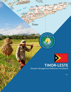
Timor-Leste’s vulnerability to natural hazards means if particular care is not taken in the development of the country’s infrastructure, it will remain at risk to disruption.
Timor-Leste developed the 2008 National Disaster Risk Management Policy, which lays out the government’s vison of ... its disaster management process from the national to the village level. Additionally, through the United Nations Development Program (UNDP), they have conducted national hazards, vulnerability and risk assessments. Through Plan International they have initiated the integration of disaster management education into public schools. Although the Government of Timor-Leste considers DRM as a priority and supports the dissemination of DRM policy to the district levels, the current Strategic Development Plan 2011-2030 of Timor-Leste has not explicitly reflected nor integrated DRM as one of its development priorities. Disaster Management is included in the Strategic Plan Document of MSS 2009-2012. more
Timor-Leste developed the 2008 National Disaster Risk Management Policy, which lays out the government’s vison of ... its disaster management process from the national to the village level. Additionally, through the United Nations Development Program (UNDP), they have conducted national hazards, vulnerability and risk assessments. Through Plan International they have initiated the integration of disaster management education into public schools. Although the Government of Timor-Leste considers DRM as a priority and supports the dissemination of DRM policy to the district levels, the current Strategic Development Plan 2011-2030 of Timor-Leste has not explicitly reflected nor integrated DRM as one of its development priorities. Disaster Management is included in the Strategic Plan Document of MSS 2009-2012. more
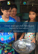
Policy Guidance Brief 1
• Climate change has already challenged the agriculture sector in Myanmar by afecting rice yields and livestock production, while disasters such as foods and cyclones have caused massive destruction in rural areas.
• Without adaptation, the long-term consequenc ... es of climate change will likely include reduced productivity and huge economic losses, food insecurity, poverty and migration.
• According to the Climate Change Action Plan for the Agriculture, Fisheries and Livestock sector, by 2030 Myanmar should achieve climate-resilient productivity and promote climate-smart responses to support food security and livelihood strategies while also introducing resource-efficient and lowcarbon practices. more
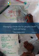
Policy Guidance Brief 2
• The potential health risks from climate change include: increase of waterborne and vector-borne diseases, heat-related illnesses, injuries and deaths, food insecurity and increased malnutrition. The poor, women, children and the elderly, as well as communities living ... in remote high-risk areas are most vulnerable.
• The expected results to achieve this outcome are: (i) climate risk management system is well-established, robust and nationally integrated to respond efectively to increased intensity and impact of risks and hazards on people’s health and wellbeing; (ii) improved social protection, gender consideration and risk finance capacity to prepare for and recover from potential loss and damage resulting from climate change; (iii) Myanmar’s health system is improved and can deal with climate-induced health hazards and support climate-vulnerable communities to respond effectively to disaster and health hazards from climate change. more
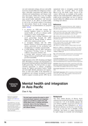
This brief report examines the extent to which community-based treatment and integration support are provided for people living with mental illness across 15 selected Asia-Pacific economies. Some of the key findings are discussed in light of the diversity of economies and cultural contexts.
BJPSYCH
...
INTERNATIONALVOLUME 15 NUMBER 4 NOVEMBER 201
more
Всемирный доклад о наркотиках 2016 года публикуется по завершении знаменательного события в истории глобальной политики в отношении наркотиков – специальной сесс�
...
�и Генеральной Ассамблеи по мировой проблеме наркотиков. В главе I представлен общий обзор ситуации с предложением опиатов, кокаина, каннабиса, стимуляторов амфетаминового ряда (САР) и новых психоактивных веществ (НПВ) и спросом на них, а также их воздействия на здоровье человека. В ней рассматриваются также научные данные о полинаркомании, обращаемости за лечением в связи с потреблением каннабиса и изменениях, произошедших после легализации потребления каннабиса в рекреационных целях в некоторых районах мира. Глава II сосредоточена на рассмотрении механизмов взаимодействия мировой проблемы наркотиков и всех аспектов устойчивого развития через призму целей в области устойчивого развития.
more
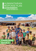
The 2018 Humanitarian Response Plan (HRP) aimed to assist 10.5 million people with direct assistance and 11.2 million people with improved access to basic services. In an effort to meet humanitarian needs, humanitarian partners provided various types of humanitarian life-saving and life-sustaining
...
assistance and services to a monthly average of 5.5 million people during 2018. Of the 5.5 million people reached on average on a monthly basis, 2.1 million were people living in areas of high severity of need, as measured through the inter-sector severity scale.
In 2018, these efforts were funded by international support to Syria with $2.19 billion raised (65 per cent of HRP requirements) by the end of the year – more than any previous year. Thanks to this generous support, humanitarian organisations in Syria continued to deliver a massive humanitarian response to people in need with multiple humanitarian crises unfolding across the country.
more

This booklet presents data on NCD mortality and prevalence of NCD risk factors, by country, for the Region of the Americas. The focus is on the 5 x 5 NCD agenda which includes the main NCDs (cardiovascular diseases, cancer, diabetes, and chronic respiratory diseases), and mental health (suicide); as
...
well as the main NCD risk factors (tobacco use, harmful use of alcohol, unhealthy diet, insufficient physical activity), along with air pollution. It includes information on the number and percentage of deaths, age-standardized death rates, premature death from NCDs and the prevalence of NCD risk f actors.
more
At TB HIV Care, we work to strengthen South Africa’s primary healthcare system by delivery people-centred services that respond to the needs of our youth, vulnerable, and underserved communities. Our programmes focus on the prevention, treatment and diagnosis of TB, HIV, viral hepatitis and relate
...
d health conditions.
more
COVID-19 has turned the world upside down. Everything has been impacted. How we live and interact with each other, how we work and communicate, how we move around and travel. Every aspect of our lives has been affected.