Filter
33
Text search:
MapAction
Featured
1
19
Language
Document type
21
4
4
2
1
1
Countries
6
6
4
3
1
1
1
1
1
1
1
Authors & Publishers
Publication Years
Category
15
4
Toolboxes
16
7
3
2
2
1
1
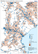
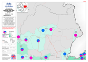
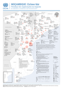
Map shows the population (based on WorldPop at 100m resolution generating through AI) and the Flood Extents known as of 19/20 March 2019 plus Health facilities
Map shows the population (based on WorldPop at 100m resolution generating through AI) and the Flood Extents known as of 19/20 March 2019
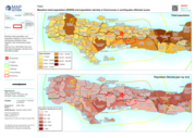
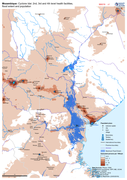
Baseline total population and population density in Communes in earthquake affected areas, together with earthquake shake map
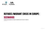
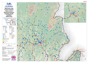
Possible developments in transit countries over the next 6 months, 24 March 2016
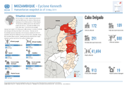
On the evening of 25 April, Tropical Cyclone Kenneth made landfall between the districts of Macomia and Quissanga in the northern province of Cabo Delgado.
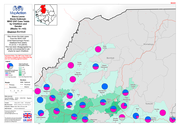
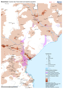
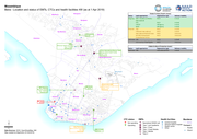
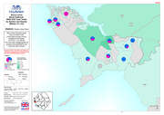
Mozambique: Cyclone Idai Responding Organisations Presence (Completed and ongoing as of 18 April 2019)
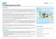
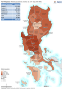
At least 2.2 million people were exposed to the earthquake, about 2,100 people have died, and more than 12,000 were injured as at 20 August. The death toll is expected to rise as the search for victims trapped under rubble continues. The Government has declared a month-long state of emergency for th
...